Skip to content

Water quality and flood risk

Challacombe rewetting meadows, Dartmoor National Park Authority

River Otter flowing through a grassy field with white flowers on the left side and trees in the distance

River Otter, Westcountry Rivers Trust

River Dart, Adrian Colston

1. About

Nature improves water quality and reduces flood risk, two vital services we depend on. However, across much of Devon these services are under great pressure from the way we manage land, treat wastewater and source drinking water as well as from run-off from roads and settlements. Climate change is increasing the impact of all these pressures.

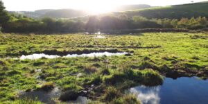
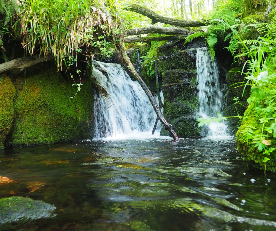
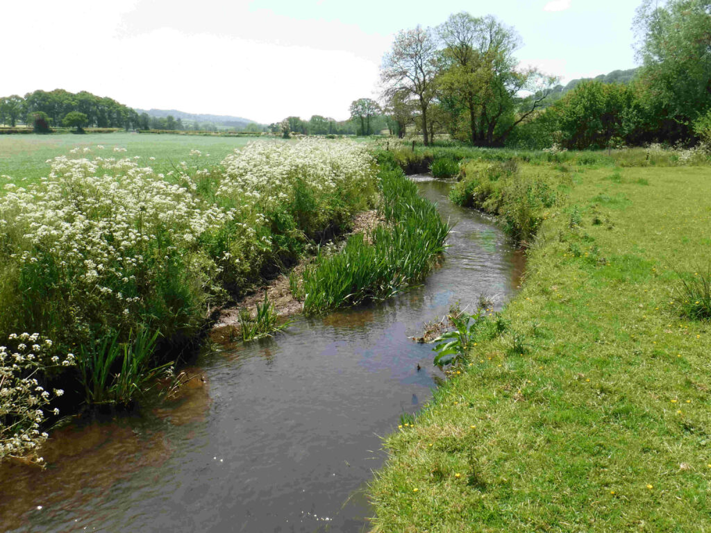
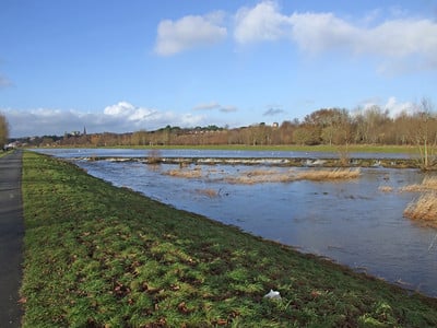
In a fully natural system, most of the rain is absorbed by the soil. It then either filters deep underground to be stored in rock formations, or runs gently through the soil, finally reaching streams and rivers. Naturally-functioning river floodplains also absorb excess flows in a complex system of wetlands and shallow channels that readily spill floodwater onto the surrounding land. These natural processes — known as natural flood management (NFM) — slow the water flow and filter out impurities.

Devon has a large and growing population of wild beavers. Beavers have returned to England after a 400-year absence and are now a protected species. They’re known as one of nature’s ecosystem engineers because they build dams to protect access to their lodges and feeding grounds. These dams help form natural wetlands that store and purify water and boost biodiversity.

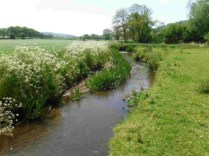
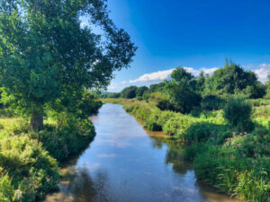
In general, the priority for NFM and to improve water quality is better soil management so that more water infiltrates into the ground. Creating more natural habitats is the next aim, as their rough surface tends to slow the flow of floodwaters. Reconnecting floodplains and other water storage techniques are also very valuable.

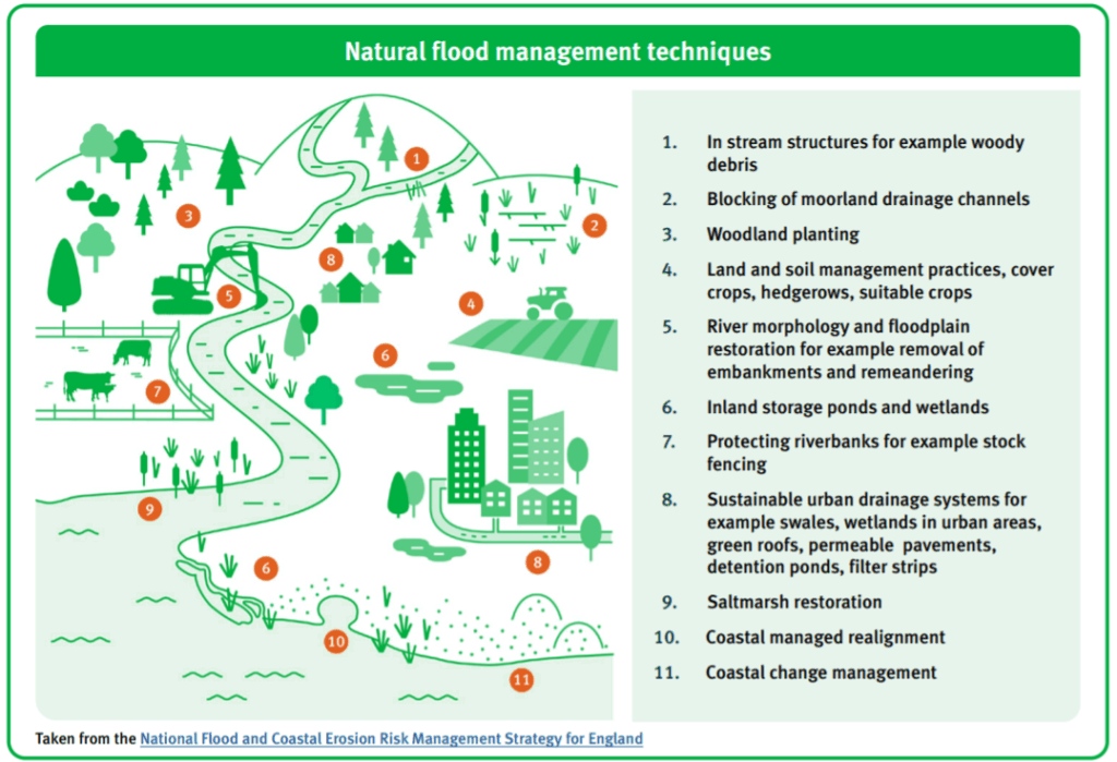
The diagram below shows some typical NFM techniques.

This image shows an annotated picture diagram of a river flowing from the tops of hills, down its catchment valley and into the sea. The image is titled 'Natural flood management techniques' and is annotated with the following comments (listed in order as the river starts to where it ends in the sea).
1) In stream structures for example woody debris.
2) Blocking of moorland drainage channels.
3) Woodland planting.
4) Land and soil management practices, cover crops, hedgerows, suitable crops.
5) River morphology and floodplain restoration for example removal of embankments and remeandering.
6) Inland storage ponds and wetlands.
7) Protecting riverbanks for example stock fencing.
8) Suitable urban drainage systems for example swales, wetlands in urban areas, green roofs, permeable pavements, detention ponds, filter strips.
9) Saltmarsh restoration.
10) Coastal management realignment.
11) Coastal change management.
This image was taken from the National Flood and Coastal Erosion Risk Management Strategy for England.

The following film shows some of these NFM techniques in action. 

We rely on these natural systems to help absorb heavy rainfall and reduce flood risk. They also help to filter out pollution so that rivers are safe to bathe in and water is drinkable without the need for vastly expensive treatment. Well-managed, expanded and better-connected wildlife-rich habitats can help repair and deliver these critical ecosystem services.

The LNRS aims to maximise the benefits of natural flood management and other ecosystem services. However, nature cannot solve all our problems. We must still improve our sewage treatment services, water supply networks, hard flood defences and reduce pollution at source to protect nature and our own health and wellbeing. 

Flooding has huge impacts on wildlife, property and people’s wellbeing.

Polluted water harms wildlife and our health, when we bathe in it and extract it as drinking water.

Some stats needed here on increasing flood events / damages; plus water quality problems affecting drinking water.

Key pressures and opportunities

We’ve changed our landscapes so much that naturally functioning soils and floodplain systems are now in short supply. This is mainly due to loss of habitats and ground that’s been compacted by high levels of livestock, heavy machinery and concrete or tarmac surfaces. When a large amount of rain falls on compacted ground it tends to run straight off, carrying pollutants that reduce the quality of the water in ponds, lakes and rivers. When rainfall is particularly high, this surface water run-off can quickly reach rivers where it gathers in force.

Restoring, expanding and connecting habitats so they create better functioning ecosystems is the most significant opportunity.

Historic methods of flood control created straighter and deeper river channels that stopped floodwaters spilling out onto the floodplain and dried out most of the original floodplain wetland systems. As a result, water is channelled more quickly towards the large urban centres that are often built low down river systems, where it frequently causes flood damage.

Climate change is a major pressure on our rivers and water resources. It’s causing more intense rainfall, leading to more frequent and longer-lasting floods. It’s also causing more intense droughts, which make periods of low flows more likely.

Many different pollutants are entering our watercourses and reducing water quality. They include phosphates, nitrates, chemicals (including pesticides, herbicides, fungicides, solvents, metals, and pharmaceuticals), microbial pathogens, dissolved organic carbon and sediments. The emergence of new chemicals is also a growing cause for concern. The Environment Agency is attempting to tackle these pollutants at source through regulation and advice to industry.

2. What we need to do and where

Priority

Manage, restore and create wildlife-rich habitats and ecosystems to help meet water quality, water resource and flood risk targets across Devon.

Actions

Every river in Devon suffers from some degree of pollution and every resident, business, landowner and land manager in the county can do something to prevent pollutants reaching our rivers. Likewise, flooding affects many areas of Devon and wherever we can, we should act to slow the flow of water to reduce flood risk and benefit wildlife.

NFM techniques such as improved soil infiltration, new wetlands, leaky dams and reconnected floodplains (see the diagram and video above) are increasingly being used to reduce flood risk, although they typically have more benefit in smaller catchments.

The LNRS aims to restore and expand natural habitats across much of Devon. Wherever this happens, the result will be better-draining soils leading to improved water quality and reduced flood risk. Creating woodlands and wetlands and farming in ways that improve soil infiltration are particularly effective.  

Reduce pollution

Everyone across Devon can take steps to prevent water pollution. See Actions on the Watercourse corridors page.

Manage, restore and create wildlife-rich habitats to store water, slow water flows and help absorb pollutants.

Managing and restoring all types of wildlife-rich habitat (and in particular soils) can slow water flows and improve water quality. See actions on the Habitats pages. However, expert advice is necessary to know which habitat will be most beneficial in which situation. See links in Find out more below.

Where we need to focus action

Actions to reduce pollution and slow water flows are needed across Devon. However, to help meet priorities relating to drinking water and flood control, actions are prioritised to the following areas.

See Mapping for the LNRS Viewer and information on how areas have been mapped (these layers are under Other useful layers>Water).

Water Quality and Flood Risk Opportunity Areas:

  • Drinking water safeguard zones for surface water and ground water. In these areas, any actions that limit pollution, improve infiltration and store water will be highly beneficial.
  • Natural Flood Management (NFM) high priority catchments. This is a process that identifies which communities in Devon have the highest risk of flood damage and then assesses where NFM can have the most benefit. In these areas, actions that improve infiltration and water storage will be highly beneficial.

Species Opportunity Areas:

  • Beaver catchments are also mapped (see Species opportunity areas>Mammals>Beaver catchments) to show where beavers are already present in the wild. Where these overlap with NFM high priority catchments, beavers are likely to provide significant NFM benefits.

The type of NFM that will be most beneficial can only be determined following field survey and detailed discussion with an expert. See links in Find out more below.

3. Inspiration

Case studies

There is a huge amount of NFM work going on across Devon. For example:

Please share any other case studies that could be listed here or in Find out more.

The Dartmoor Headwaters project

The Dartmoor Headwaters project is delivered by Dartmoor National Park, the Environment Agency and Devon County Council. It focuses on the headwaters of several Dartmoor rivers, using NFM to reduce flood risk in towns downstream.

The Climate Resilient Otter Catchment

The Climate Resilient Otter Catchment (CROC) project, funded and led by the Environment Agency, is supporting farmers and landowners in the River Otter catchment to improve the condition of their soils so they’re able to soak up more water and reduce the risk of flooding after intense rainfall.

River Otter flowing through a grassy field with white flowers on the left side and trees in the distance

Managing flood risk in Plymouth

As a statutory Lead Local Flood Authority (LLFA), Plymouth City Council has worked with the Environment Agency and South West Water to produce a Local Flood Risk Management Strategy. The strategy gives an overview of flood risks for the city and explains how these risks are managed. It also highlights the importance of managing flood risk in the neighbouring catchments and watercourses that border and flow into Plymouth. This is necessary to ensure that flood risk is managed and mitigated by new development in those areas, using natural flood management where possible.

As part of this, the Environment Agency’s Land Management Team is in engaging with Plymouth’s neighbouring landowners to raise awareness of flood risk associated with run-off and promote good land management practice to manage run-off risk.

Upstream Thinking

South West Water is delivering Upstream Thinking, a major programme to improve water quality in our rivers and seas.

Friends of the Dart

Friends of the Dart is working to designate bathing waters and improve water quality.

4. Find out more

Will be finalised following consultation please share any missing links to useful information and advice.

The Environment Agency, Natural England and the Forestry Commission can provide further advice. Many other organisations also employ farm and wildlife advisors who may be able to support.

Devon County Council’s flood risk team have published useful guidance on natural flood management.

Plymouth City Council’s Local Flood Risk Management Strategy

https://www.gov.uk/flood-and-coastal-erosion-risk-management-research-reports/working-with-natural-processes-to-reduce-flood-risk-2024

Devon and Cornwall Natural Flood Management Studio Dashboard – useful to assess potential NFM measures but do back this up with site surveys and expert input. https://atkinsgeospatial.maps.arcgis.com/apps/MapSeries/index.html?appid=ed51f0997bee4576b83e851600bbddda

https://environment.data.gov.uk/farmers/ shows the Drinking Water Safeguard Zones. For each Zone, you can download an Action Plan that describes the reasons for its designation and the actions needed – just click on the Zone in the map.  

The Connecting the Culm project is focused on reducing flood risk in the Culm catchment using NFM. A key target is to reduce the risk of closure of the main railway line to the region, which is currently flooded on average once a year.  

The Devon Resilience Innovation Project (DRIP) is funded by the Environment Agency and is usig NFM, alongside other measures, to reduce the risk of flooding in “rapid-response” flash flooding locations across Devon.

Westcountry Rivers Trust Citizen Science programme provides training for volunteers in water quality testing.  

Search this site:

clear